Upper Dawson eDNA Project
A citizen science program to detect and protect platypuses in Banana Shire
© Wildlife Qld
About this project
In 2021, the ‘PlatypusWatch eDNA in the Dawson River’ project — proudly supported by $26,930 from the Queensland Government’s Queensland Citizen Science Grants — began to survey and document the distribution of platypuses within the Upper Dawson River and tributaries around the Taroom region. By educating and connecting with the local community and harnessing their knowledge and people power, the project aimed to implement an ongoing program to protect platypuses in the region.
Workshops at Taroom and Theodore trained 31 participating citizen scientists in both best practice observational surveying and eDNA collection procedures. After the workshops, several volunteers took their newly acquired skills and eDNA sampling packs to test water from the river or its tributaries on their properties or at allocated sites. Overall, 19 sites were sampled along the Dawson River, from Moura to west of Taroom.
 © Tamielle Brunt
Local citizen scientists were thrilled to see platypuses in nearby waterways.
Workshops for the project were held at Theodore and Taroom and participants were then invited to test their local waterways, with several families and attendees successfully finding evidence of platypus occupation.
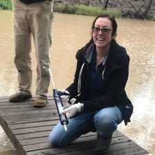
Tamielle testing
Our Platypus Protector, Tamielle, demonstrating the sampling process.


Data gathered
Platypuses were discovered at the following locations and mapping updated as shown below.
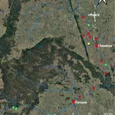
Map of eDNA results near Taroom
Five sites (green) were positive for platypus DNA in four areas: Kianga River Rd crossing, Isla–Delusion Rd crossing, Tarana Crossing, and the Santos Site. One site was equivocal (yellow), meaning the test was unable to prove with certainty that platypus eDNA was present.
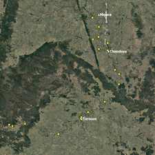
Sites sampled
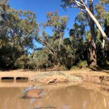
19 sites (shown below) were sampled along a ~60 km stretch of the Dawson River from Moura out to the Santos property in the west.
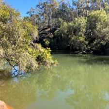
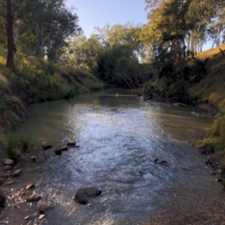
Tarana Crossing, West Taroom
Platypuses prefer clear, flowing water with runnels and stable banks.
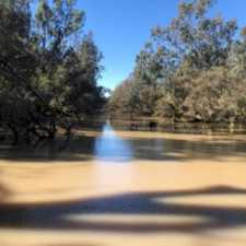
Isla–Delusion Rd Crossing
Surprisingly, platypuses sometimes appear in places that might not look like ideal habitat, making observational records even more important.
Platypuses in the Upper Dawson brochure
Members of the project team worked closely with Wildlife Queensland’s Upper Dawson Branch, the Society’s local branch in the Dawson River catchment. A region-specific guide to help residents understand the needs of platypuses and the techniques used to conserve them was also produced.
The brochure is available to view as a flipbook and can also be printed or downloaded form the flipbook. Alternatively, Email us to request a printed copy.
To view the brochure:
- Press the > button to start or click on the pages.
- Use the RIGHT and LEFT arrows to move forward or back.
- Click on the DOWNLOAD button (cloud and arrow) to download.
Project outcomes
- Over 3 years, 26 sites eDNA sampled over a 350km stretch of the Upper Dawson River.
- A mix of results over the three years between positive and equivocal (maps).
- Platypus are persisting in the region but how many and how well needs more investigation.
- We identified that the threats are related to barriers from weirs, turbidity impacting their food source and erosion of banks impacting nesting sites.
- The habitat is suitable for platypuses because of the permanent water with refuge pools, intact riparian vegetation and high stable banks.
Partners & sponsors
Since the launch of PlatypusWatch (previously known as PlatypusCare) in 2003, many groups, individuals and institutions have supported us and worked with us to embrace platypus surveys, monitoring and research. Some of those are listed below.
- Proudly supported by the Queensland Government — Queensland Citizen Science Grants.
- Gold Coast Catchment Association
- Moggill Creek Catchment Group
- University of Queensland Cool Pools
- Western Catchments
- Wildlife Queensland Bayside Branch